
The Bay of Bengal could generate successive low-pressure systems through August, bringing widespread rain to central, eastern and northern India and potentially easing rainfall deficits.
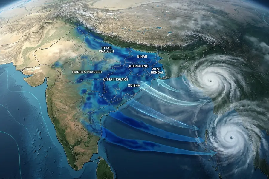
The monsoon may be far from taking a break. A potentially active Bay of Bengal could keep sending rain systems across India through the rest of August.
India’s monsoon could be entering a particularly active phase, with weather models indicating that the Bay of Bengal may continue generating low-pressure systems one after another through the rest of August.
Bay of Bengal could keep the monsoon active
Forecast guidance suggests the Bay of Bengal could remain unusually active over the coming weeks, repeatedly producing low-pressure areas that move inland and carry large amounts of moisture.
The latest ECMWF rainfall projections, analysed by Weathernerds, point to widespread rainfall over parts of central, eastern and northern India during the next 15 days.
The key positive signal is the absence of a prolonged monsoon break over the core monsoon zone.
Which regions could see repeated rain?
Successive weather systems could bring repeated spells of rain to:
- Odisha
- West Bengal
- Jharkhand
- Bihar
- Chhattisgarh
- Madhya Pradesh
- Uttar Pradesh
- Parts of northeast India
The systems could also influence rainfall patterns across adjoining parts of central and northern India.
Why the lack of a monsoon break matters
A prolonged monsoon break can sharply reduce rainfall across large parts of the country and worsen seasonal deficits.
An uninterrupted sequence of rain-producing systems, by contrast, could help maintain monsoon circulation and distribute rainfall more regularly.
If the current forecast materialises, repeated rainfall could help reduce existing rainfall deficits in some regions.
Could this help agriculture?
The outlook could be particularly important for the ongoing kharif season.
Repeated rainfall across agricultural regions could improve: Soil moisture, Water availability, Reservoir levels, Crop conditions, Irrigation availability.
The potential benefits would depend heavily on where and how intensely the rain falls. Excessive rainfall in a short period could also create flooding, waterlogging and crop damage in vulnerable areas.
What about El Niño-like conditions?
Concerns had remained over the potential influence of El Niño-like conditions on India's monsoon.
El Niño is generally associated with weaker monsoon rainfall over India. However, a persistent sequence of Bay of Bengal low-pressure systems could help sustain rainfall despite broader climate influences.
The current forecast therefore offers a more encouraging picture for the second half of August, although it does not eliminate seasonal uncertainty.
Rajasthan sees heavy rain
Active monsoon conditions were also reported in Rajasthan on Friday.
Chittorgarh and Mount Abu received heavy rainfall, while several other districts recorded light to moderate showers in the 24 hours ending at 8.30 am.
Nimbahera in Chittorgarh recorded 98 mm of rainfall, the highest in the period, according to the Jaipur Met Centre. Bhilwara, Sirohi, Jaipur and Baran also received rainfall.
Why the next few weeks matter
The Bay of Bengal is one of the most important sources of rain-bearing systems during the Indian monsoon. When low-pressure systems repeatedly form there and move inland, they can transport moisture deep into the subcontinent and trigger widespread rainfall.
The current forecast is significant because it suggests that this process could continue through much of August rather than being interrupted by a prolonged break.
For regions facing rainfall deficits, this could provide an opportunity for recovery. Better soil moisture and reservoir inflows could also support agriculture and water availability.
But a hyperactive monsoon is not automatically beneficial everywhere. If several systems track over the same areas, intense or prolonged rainfall could increase the risks of flooding, landslides and waterlogging.
Forecast confidence also decreases further into the future. Therefore, the projected sequence of systems should be treated as an evolving forecast rather than a guarantee of continuous rainfall.
The immediate takeaway is that the Bay of Bengal could remain the main driver of India's weather through the rest of August, with central, eastern and northern India likely to remain among the key areas to watch.
Published: 14 Aug 2026, 02:32 pm IST
ABOUT THE AUTHOR

Related Topics
Disclaimer: Kindly avoid objectionable, derogatory, unlawful and lewd comments, while responding to reports. Such comments are punishable under cyber laws. Please keep away from personal attacks. The opinions expressed here are the personal opinions of readers and not that of Mathrubhumi.