
China’s Shijian-31 has drawn international attention for using an unusual 63.4-degree highly elliptical orbit that can repeatedly observe the geostationary belt from above. Public orbital analysis suggests the spacecraft can shift its vantage point by roughly 15.7 degrees each pass and sweep the GEO arc in about 23 days.
About 36,000 kilometres above the equator runs an invisible ring we never see but lean on daily. Television pictures, cyclone alerts, banking links and military messages all travel through the satellites parked there. It is the most valuable address in space. This year, a Chinese spacecraft began circling that ring in a manner nobody had recorded before.
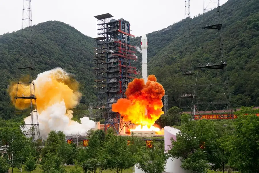
It began on 16 June, when a Long March 3B rocket lifted off from Xichang carrying a satellite called Shijian-31. Beijing called the mission "space environment detection", which sounds like harmless weather study. But a satellite cannot hide its path. Trackers followed it, measured it, and the numbers told a very different story.
Also Read: America says it has space weapons; What it means for India and the World
Two words are worth separating here. A geosynchronous satellite takes exactly one day to circle Earth, so it returns to the same place at the same hour, though it may wander in a small figure of eight. A geostationary one does the same while sitting precisely over the equator, so it seems nailed to one spot in the sky, like a lamp hung permanently above a chosen city. That fixed ring is what everyone wants.
Watching the ring from the ground is thankless work. Cloud, haze, daylight glare, trembling air and the curve of the horizon keep interrupting the view. An eye placed in space suffers none of this.
The American firm Integrity ISR worked out Shijian-31's path, and its shape is the whole story. It does not travel a neat circle but a long, drawn-out oval, stretched about as far as an orbit can reasonably be stretched; those who like precise figures call it 0.69, where zero would mean a perfect circle.
Also Read: Would you like to carry a piece of an aircraft in your pocket?
At its nearest the satellite passes roughly 2,000 kilometres above us, and at its farthest it swings out to nearly 40,000 kilometres, comfortably above the ring it is studying. Like a ball tossed upward, it rushes when near and almost dawdles when far, and that slow, high-up dawdle is exactly the moment for looking down at leisure.
The tilt of its path, 63.4 degrees to the equator, is the real giveaway. The Soviet Union chose precisely this angle in the 1960s for its Molniya satellites, a name meaning lightning, launching around forty of them between 1965 and 1974 from a much lower closest point of about 500 kilometres. They needed it because an equator-bound satellite could scarcely see Moscow's far north.
Earth's gravity, however, is not perfectly even, and that unevenness slowly rotates a stretched orbit, rather like the long hand of a clock creeping around the dial, dragging the satellite's lingering point away from where it was wanted. At 63.4 degrees, the creeping stops dead. The oval stays aimed where its operators pointed it.
China borrowed the trick and turned it outward. As The Print has reported, Shijian-31 keeps its far point over the equatorial region rather than the Arctic, and then adds one clever touch.
A Molniya loop takes twelve hours, bringing the satellite back over the same longitude each time. Shijian-31 takes twelve and a half, so it always arrives a little late, by which moment Earth has turned further beneath it. Each loop therefore leaves it hovering a short step west of the last, about 15.7 degrees.
Pass after pass it shuffles along the ring, and in roughly twenty-three days it has quietly inspected the whole of it. COMSPOC, an American space-tracking software company, called it an orbit it had never seen before.
What should hold our attention is that this is no lone experiment. Four earlier Chinese spacecraft have already flown similar stretched paths, which makes Shijian-31 the fifth of that family to be identified. Two were from the Shijian-10 pair; the other two carried the plainer labels TJS-13 and TJS-21.
Then, in 2025, two more Chinese craft did something bolder. Shijian-21 and Shijian-25 edged closer and closer to each other high above Earth, until watchers saw a single point of light where two had been, and concluded they had probably joined together. Beijing never confirmed it.
Placed side by side, these missions reveal a plan: China wants to know not merely where satellites sit, but how they move and what they do.
For India, that is close to home. Our INSAT and GSAT satellites share the very same ring. GSAT-30 carries communication traffic over India and neighbouring regions, while GSAT-31 added Ku-band transponder capacity, a transponder being a relay box that catches a signal from the ground and sends it back down, Ku-band being the radio channel it works on. Should relations sour, such links could be studied or disturbed by a watcher already overhead.
India has not been idle. On 4 September, ISRO launched EOS-05 aboard GSLV-F17, described as India's first imaging satellite meant to work from geosynchronous orbit, now being guided towards 85.5 degrees east. The logic is lovely in its simplicity: rise higher, and one glance covers far more land.
Our capability, though, still trails, and our engineers say so honestly. But EOS-05 is the first rung of a patient climb, built by people who refuse to let this sky be watched by others alone.
The author is an award-winning science communicator and a Defence, Aerospace & Geopolitical Analyst.
Published: 19 Sept 2026, 11:25 am IST
Related Topics
Disclaimer: Kindly avoid objectionable, derogatory, unlawful and lewd comments, while responding to reports. Such comments are punishable under cyber laws. Please keep away from personal attacks. The opinions expressed here are the personal opinions of readers and not that of Mathrubhumi.
