
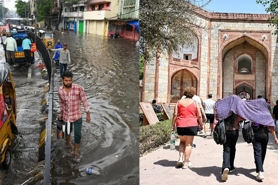
New Delhi: India is currently experiencing sharply contrasting weather patterns, with intense heat building in the north and significant rainfall forecast across the south and east. The India Meteorological Department (IMD) has issued multiple warnings as the country enters peak summer.
Northern India sees rising temperatures
While Delhi remains outside a formal heatwave warning for now, temperatures are on the rise and could climb further after 7 April. Parts of northwestern India are already showing extreme heat. Barmer in Rajasthan recorded a high of 40.2°C on 2 April.
IMD has issued a heatwave alert for:
- Saurashtra and Kutch: till 8 April
- Rajasthan: from 6 to 9 April
- Punjab and Haryana: from 7 to 9 April
Northern and central regions such as Gujarat, Madhya Pradesh, eastern Uttar Pradesh, and Maharashtra are expected to see temperature spikes between 3°C and 5°C over the coming week.
Cyclonic systems drive rainfall in southern and eastern India
A cyclonic circulation over Kerala and another forming near West Bengal and Bangladesh have triggered rainfall alerts across southern states. IMD has forecast moderate to heavy rainfall and thunderstorms in:
- Tamil Nadu, Kerala, Karnataka, and Puducherry: until at least 6 April
- Andhra Pradesh and Telangana: light to fairly widespread showers with gusty winds (30–40 km/h)
Yellow alerts have been issued in several Tamil Nadu districts including Coimbatore, Erode, Madurai, and Tirunelveli. In Kerala, alerts are active today (5 April) in Idukki, Palakkad, Malappuram, and Wayanad, where isolated heavy rainfall between 64.5 mm and 115.5 mm is expected in 24 hours.
Black sea phenomenon and coastal erosion warnings
The National Centre for Oceanographic Studies and Research (INCOIS) has issued warnings for potential coastal erosion caused by high waves due to the black sea phenomenon. Affected regions include:
- Thiruvananthapuram district (Kappil to Poovar): from 11:30 AM on 5 April to 11:30 AM on 6 April
- Kollam district (Alappat to Edava): from 2:30 PM on 5 April to 11:30 AM on 6 April
Residents in these areas have been advised to avoid the coast and follow local advisories.
Central and eastern states may see more storms
Cyclonic systems affecting Sub-Himalayan West Bengal and southwest Madhya Pradesh are forecast to bring thunderstorms, rain, and possibly hail to parts of:
Madhya Pradesh, Odisha, Chhattisgarh, Jharkhand, Telangana, and Andhra Pradesh
Wind speeds may reach 40–50 km/h in Bihar, Jharkhand, and West Bengal. The northeast is also on alert for thunderstorms and lightning across Assam, Nagaland, Manipur, Mizoram, and Tripura.
IMD Director General Mrutyunjay Mahapatra has forecast a hotter-than-average April to June season, although El Nino conditions are not expected during the monsoon. He noted that increased frequency and severity of heatwaves may impact large parts of central and western India.
Mumbai: High humidity persists
Mumbai continues to experience humid conditions, with humidity at 71% and temperatures ranging from 24°C to 31°C. No rainfall is expected today (5 April), although the city saw light showers earlier in the week. The Air Quality Index stands at 90, considered satisfactory but slightly uncomfortable for sensitive groups.
As India grapples with climatic extremes, authorities are urging citizens to stay updated on local forecasts, take precautions against heat exposure, and remain alert in rain-affected regions.
Published: 05 Apr 2025, 07:48 am IST
Related Topics
Disclaimer: Kindly avoid objectionable, derogatory, unlawful and lewd comments, while responding to reports. Such comments are punishable under cyber laws. Please keep away from personal attacks. The opinions expressed here are the personal opinions of readers and not that of Mathrubhumi.
