
The name 'Murasu' was contributed by India to the regional cyclone naming list.
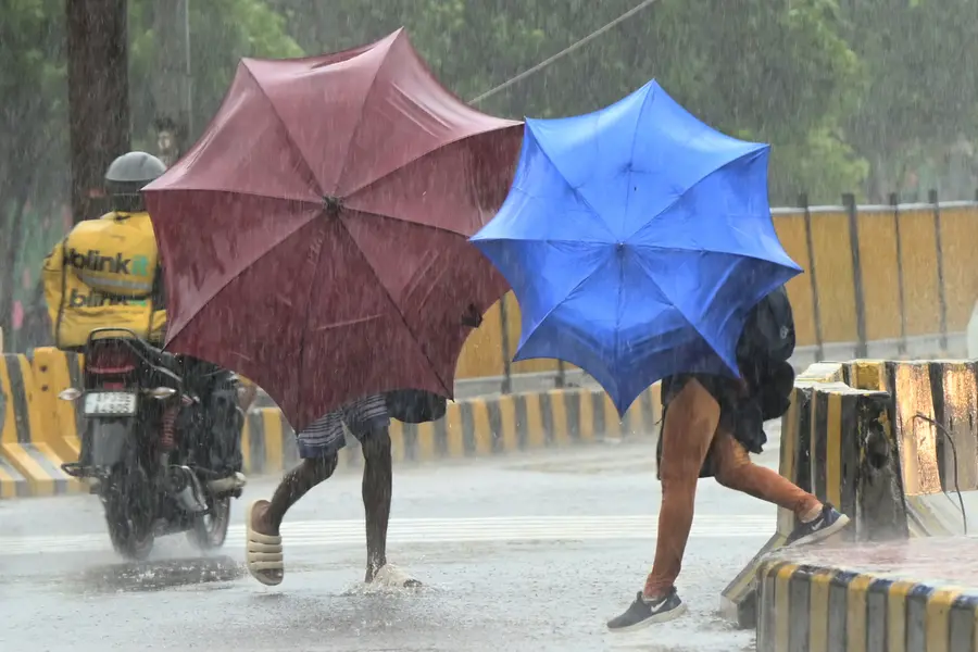
The India Meteorological Department (IMD) has announced that a weather depression has formed over the Bay of Bengal, which is forecast to intensify into a cyclonic storm by Sunday, November 1. If the system develops as predicted, it will be named Cyclone Murasu. The storm is expected to move towards the Andhra Pradesh coast and cross near Machilipatnam between Monday, November 2, and Tuesday morning, November 3. Coming just days after Cyclone Arnab, Murasu will be the second cyclonic storm to form over the Bay of Bengal this year.
IMD Director General Mrutyunjay Mohapatra said that the cyclone is likely to bring wind speeds of 80 to 90 kilometres per hour, with gusts reaching up to 100 km/h. Weather authorities have issued a stern warning to fishermen, advising them not to venture into the sea until at least Wednesday afternoon, November 4, and urging those currently at sea to return to harbour immediately. From Sunday onwards, sea conditions across the west-central, southeast, and parts of the central Bay of Bengal will become hazardous for all boats and small ships, making the area dangerous for navigation.
Coastal regions brace for heavy rainfall and thunderstorms
The advancing storm system is set to bring substantial rainfall across several eastern coastal states. Andhra Pradesh and the Rayalaseema region are predicted to receive very heavy rainfall on November 2 and 3, with isolated places facing extremely heavy downpours. Southern Odisha is also expected to witness heavy rain on November 3 and 4.
According to V R Durai, director of the Area Cyclone Warning Centre at the Regional Meteorological Centre (RMC) in Chennai, the storm's outer rain bands may extend over north coastal Tamil Nadu. Consequently, moderate rainfall is expected in north coastal Tamil Nadu from November 1 to 3, while isolated spots in Tiruvallur district could see heavy rain accompanied by thunderstorms and lightning. For Chennai and neighbouring areas, light to moderate rain with thunderstorms is forecast for Sunday, with maximum temperatures around 33–34°C and minimum temperatures between 25–26°C.
Ancient drum inspires the name of India's new storm
The name 'Murasu' was contributed by India for the regional cyclone naming list. Rooted in Tamil, 'Murasu' refers to a traditional percussion drum and ancient musical instrument. In ancient times, this drum served a vital social role, used specifically for disseminating public information and announcements across villages and kingdoms.
The naming of tropical cyclones in the region follows a standard global procedure managed by the Regional Specialised Meteorological Centre (RSMC) in New Delhi. Worldwide, weather monitoring and storm naming are overseen by six regional specialized centres and five regional tropical cyclone warning centres. As one of these specialized centres, RSMC New Delhi provides storm surge and tropical cyclone advisories to 13 member nations: Bangladesh, India, Iran, Maldives, Myanmar, Oman, Pakistan, Qatar, Saudi Arabia, Sri Lanka, Thailand, the United Arab Emirates, and Yemen.
IMD had released a comprehensive list containing 169 cyclone names, assembled by collecting 13 name suggestions from each of the 13 member countries. India’s contributions include names such as Gati, Tej, Murasu, Aag, Vyom, Jhar, Probaho, Neer, Prabhanjan, Ghurni, Ambud, Jaladhi, and Vega, while Bangladesh contributed names including Nisarga, Biparjoy, Arnab, and Upakul.
Broader climate trends show drier November despite back-to-back storms
Despite the rapid formation of Cyclone Arnab and the impending arrival of Cyclone Murasu, overall weather forecasts point to a drier-than-usual November 2026 across most of India. South Peninsular India is expected to record below-normal rainfall, falling under 77 per cent of the long-period average (LPA), with rain deficits anticipated across most of the country except for parts of central, northwest, and northeast India. Day and night temperatures are likely to remain above normal across most regions, barring the Himalayan foothills and central and eastern India. On the global climate front, strong El Niño conditions persist in the Pacific, while the Indian Ocean Dipole remains neutral.
Looking at the broader seasonal transition, the southwest monsoon completed its countrywide withdrawal around October 14–15 after commencing its retreat on 19 September, a timeline described by the IMD chief as near-normal. Shortly after, the northeast monsoon set in on October 15 over Tamil Nadu, Puducherry and Karaikal, Rayalaseema, coastal Andhra Pradesh, south interior Karnataka, and Kerala-Mahe, maintaining normal to above-normal activity since its arrival.
Published: 31 Oct 2026, 09:47 pm IST


Disclaimer: Kindly avoid objectionable, derogatory, unlawful and lewd comments, while responding to reports. Such comments are punishable under cyber laws. Please keep away from personal attacks. The opinions expressed here are the personal opinions of readers and not that of Mathrubhumi.
