
‘Cyclone Arnab’ is officially a deep depression, but heavy rain, thunderstorms and gusty winds continue to threaten Bengal.
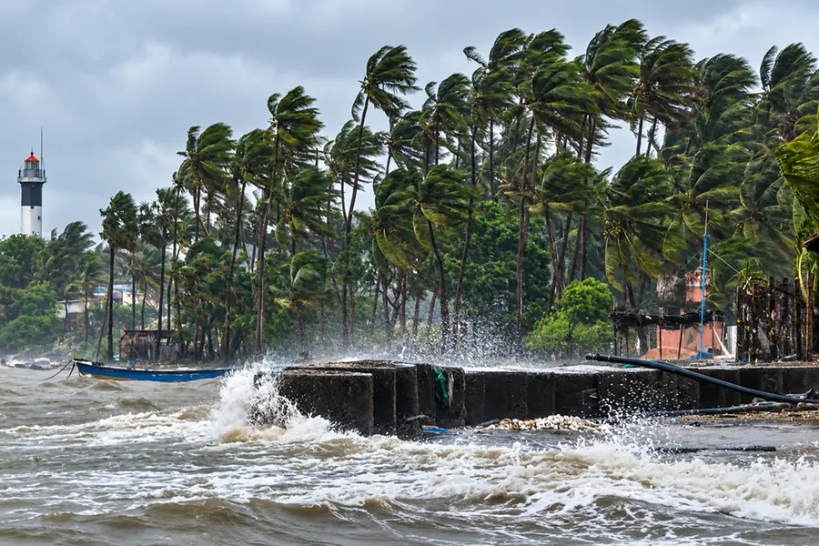
The word ‘cyclone’ may have been dominating social media feeds, but the India Meteorological Department has drawn a clear line: the system being referred to as ‘Arnab’ is not a cyclone.
It is a deep depression, and Kolkata still has plenty of rain to contend with.
The weather system over the Bay of Bengal has brought heavy rain, thunderstorms and gusty winds across parts of Bengal, Odisha and Andhra Pradesh.
But despite the growing public attention around it, the system has not attained the wind speed required for classification as a cyclonic storm.
The deep depression currently has maximum sustained winds of 55-65 kmph, with gusts reaching 75 kmph. Under the IMD's classification, a deep depression has an average wind speed of 50-61 kmph, while a cyclonic storm requires wind speeds of 62-88 kmph.
That distinction matters because the system widely being described online as “Cyclone Arnab” does not officially qualify for the cyclone tag.
According to the IMD, the deep depression over the north Andhra Pradesh coast moved slowly west-northwestwards at around 3 kmph at 6 am.
It crossed the coast close to southwest of Kalingapatnam between 11 pm on September 23 and 1 am on September 24, carrying maximum sustained winds of 55-65 kmph and gusts of up to 75 kmph.
The system subsequently moved west-northwestwards and was located over north coastal Andhra Pradesh.
It was around 50 km west of Kalingapatnam, 80 km north-northeast of Visakhapatnam and 170 km southwest of Gopalpur in Odisha.
The latest IMD bulletin says the system is likely to continue moving northwestwards while maintaining its deep-depression intensity for the next 12 hours.
It is then expected to turn north-northwestwards and gradually weaken over the following 24 hours.
The IMD's latest sea-area bulletin similarly says the system is likely to weaken into a depression around the evening of September 24.
For West Bengal, however, the weakening system does not mean an immediate end to the rain threat.
On September 24, East Midnapore, West Midnapore and Jhargram are expected to receive heavy to very heavy rain at one or two places, prompting orange alerts.
Kolkata and neighbouring Howrah, Hooghly, North 24 Parganas and South 24 Parganas are under yellow alerts for heavy rain.
The weather office has also issued orange alerts for South 24 Parganas, East Midnapore and West Midnapore on September 25.
Thunderstorms, lightning and gusty winds reaching 40-50 kmph are likely at one or two places in these areas.
For Kolkata, the immediate forecast is of a generally cloudy sky, accompanied by a few spells of light to moderate rain or thundershowers. An intense spell of rain is also possible.
And that could be enough to create familiar urban headaches.
The IMD has warned of waterlogging in low-lying parts of Kolkata and possible closure of underpasses.
Visibility could temporarily fall during intense spells of rain, while waterlogged roads and poor visibility may disrupt traffic, increase travel time and contribute to incidents on the road.
The broader weather outlook offers some relief. Conditions are expected to become clearer around Saturday, September 26, although light to moderate rain or thundershowers are still likely at many places across the districts of south Bengal.
The Regional Meteorological Centre, Kolkata has also indicated that warnings ease after September 25, with no warning listed for Gangetic West Bengal on September 26.
For now, fishermen have been advised not to venture into the sea along and off the West Bengal and Odisha coasts, the North Bay of Bengal and the Westcentral Bay of Bengal until September 25.
So, while Kolkata may have avoided a full-fledged cyclone, the city is not escaping the weather system's impact.
The ‘cyclone’ label may be inaccurate, but the rain, waterlogging and travel disruption it has brought are very real.
Published: 24 Sept 2026, 07:09 pm IST
ABOUT THE AUTHOR

Related Topics
Disclaimer: Kindly avoid objectionable, derogatory, unlawful and lewd comments, while responding to reports. Such comments are punishable under cyber laws. Please keep away from personal attacks. The opinions expressed here are the personal opinions of readers and not that of Mathrubhumi.