
Tamil Nadu plans high-tech mapping of blue carbon ecosystems using drones and AI.
Chennai: Tamil Nadu is preparing to launch a major scientific initiative to accurately map its blue carbon ecosystems, including mangroves, seagrass meadows and tidal marshlands, using drones, artificial intelligence (AI) and cloud computing.
The project aims to generate high-resolution data on coastal carbon storage and create a comprehensive Blue Carbon Atlas for Tamil Nadu, which could help the state participate in emerging global carbon markets and climate finance programmes.
According to current estimates, Tamil Nadu has around 90 sq km of mangroves, nearly 800 sq km of seagrass beds, and about 64 sq km of tidal marshlands. However, scientists say these figures remain uncertain because the ecosystems have not been mapped comprehensively.
Need for accurate blue carbon mapping
Existing estimates are largely based on extrapolations from limited field samples collected across large coastal stretches. This has resulted in differences between state-level and national data on coastal blue carbon ecosystems in Tamil Nadu.
Researchers say precise measurement of carbon stocks is essential if the carbon captured in mangroves, seagrass and tidal marshlands is to be scientifically verified and traded in international carbon markets.
To address this gap, scientists from the M S Swaminathan Research Foundation (MSSRF), in collaboration with the Tamil Nadu Forest Department and with technical support from Microsoft, have launched a high-precision coastal mapping project.
“Mangroves store nearly five times more carbon than terrestrial forests,” said R Nagarajan, head of GIS and remote sensing at MSSRF, who is leading the initiative. He added that the project will help determine the exact extent of mangrove cover in Tamil Nadu and identify degraded areas that require restoration.
Also Read| BSNL's indigenous 4G: Call drops, ‘switched off’ alerts frustrate users
Drones and LiDAR technology for coastal ecosystem study
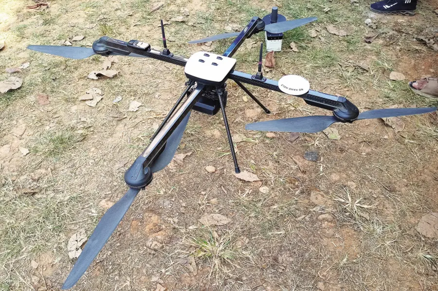
The mapping effort will use military-grade drones equipped with multispectral sensors, capable of capturing imagery at 2–5 centimetre resolution. This is significantly sharper than earlier satellite-based mapping, which generally provides imagery at about 10 metres resolution.
The sensors will allow scientists to analyse vegetation characteristics and identify different mangrove species with greater accuracy.
The project will also deploy Light Detection and Ranging (LiDAR) technology to measure canopy height, a key factor used in estimating forest biomass and carbon storage.
Data collected from drones will be integrated with satellite imagery and field samples gathered on the ground to ensure accuracy.
Calculating carbon stocks in coastal ecosystems
In the final stage of the study, researchers will assign a specific carbon value to each mapped pixel, enabling precise estimates of both above-ground and below-ground carbon stocks in mangrove ecosystems.
The survey will also include mapping of tidal marshlands located alongside mangrove habitats.
Mapping seagrass meadows poses additional challenges because drones flying about 15 metres above the water surface can detect vegetation only up to roughly five metres underwater. Despite these limitations, major marine ecosystems such as the Gulf of Mannar and Palk Bay, which host extensive seagrass beds and support endangered dugongs, will be included in the project.
Also Read| From 3 hours to 6 minutes: How Seoul’s new AI shield protects victims of cyber crimes
Blue Carbon Atlas to support conservation and climate policy
Scientists say the project will culminate in the publication of a digital and printed Blue Carbon Atlas of Tamil Nadu.
The atlas is expected to provide policymakers, conservationists and researchers with a powerful tool to protect coastal ecosystems, guide restoration efforts and explore climate finance opportunities through carbon markets.
IANS
Published: 05 Mar 2026, 10:33 am IST
Disclaimer: Kindly avoid objectionable, derogatory, unlawful and lewd comments, while responding to reports. Such comments are punishable under cyber laws. Please keep away from personal attacks. The opinions expressed here are the personal opinions of readers and not that of Mathrubhumi.
