
A Bay of Bengal depression is intensifying, with Odisha and Andhra Pradesh facing heavy rain, strong winds and possible flooding.
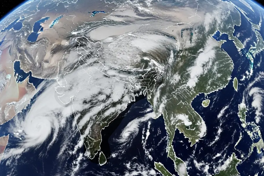
A depression over the Bay of Bengal is moving towards the Odisha-Andhra Pradesh coast and is expected to intensify into a deep depression, bringing heavy to extremely heavy rain and strong winds over the next few days.
The weather system over the westcentral and adjoining northwest Bay of Bengal is moving west-northwestwards towards the north Andhra Pradesh-south Odisha coast.
Also Read

The India Meteorological Department (IMD) expects the depression to strengthen into a deep depression and cross the coast between Visakhapatnam and Gopalpur from the night of September 23 into the early hours of September 24.
The system is already producing rain along parts of Odisha and Andhra Pradesh, with the heaviest conditions expected around September 23 and 24.
Odisha rainfall alert
Odisha is expected to see heavy to very heavy rainfall, with extremely heavy rain possible at isolated locations on September 23 and 24. The IMD has also forecast very heavy rain on September 25 and heavy rain on September 26.
The districts facing a higher risk of flash flooding include Gajapati, Ganjam, Nayagarh, Puri and Khurda.
The weather system has prompted authorities to step up preparedness, including keeping shelters ready and monitoring coastal districts for possible evacuation and relief operations.
Andhra Pradesh to see heavy rain and strong winds
Coastal Andhra Pradesh is also expected to experience widespread rainfall. The IMD has forecast very heavy rain on September 22 and extremely heavy rain on September 23 and 24, with heavy rain continuing in isolated areas on September 25.
Vizianagaram and Srikakulam have been identified among the areas facing a low to moderate flash-flood risk.
The system is also expected to bring strong winds along and off the south Odisha-north Andhra Pradesh coast. Winds could reach 55-65 kmph, gusting to 75 kmph, around September 23-24.
Will it become a cyclone?
The current system is forecast to intensify into a deep depression, but that does not automatically mean it will become a cyclone.
Current IMD forecasts focus on its movement towards the Odisha-Andhra coast and its potential to produce heavy rainfall and strong winds. Recent reporting citing the IMD also said there was no cyclone forecast at that stage.
Nepal also faces a rain alert
The weather system could have effects beyond India's eastern coast. Nepal's Department of Hydrology and Meteorology has warned of increased rainfall from around September 24 to 27 as the system moves west-northwestwards.
Lumbini, Madhesh and Koshi provinces could receive higher-intensity rainfall, while parts of Koshi, Bagmati and Gandaki may also experience rain.
The warning comes while Nepal is still dealing with the aftermath of severe flooding, including ongoing search, rescue, relief and identification operations.
Why the next few days matter
The main concern is the combination of heavy rainfall, strong winds, waterlogging and possible flash flooding as the system approaches the coast.
The period around September 23-24 is particularly important because the system is expected to reach the Odisha-Andhra coast during this window, while both states are forecast to receive very heavy to extremely heavy rainfall.
Authorities and residents in vulnerable areas have been advised to monitor official weather updates, particularly in low-lying and flood-prone locations.
The system highlights how a depression, even without becoming a named cyclone, can produce significant weather impacts. Its west-northwestward track places southern Odisha and coastal Andhra Pradesh directly in the zone expected to receive the strongest rainfall.
The immediate risks are flooding, waterlogging, disruption to transport and damage from strong winds, particularly in areas already vulnerable to heavy monsoon rain.
Its projected movement also explains why parts of Nepal could see increased rainfall several days later, as the weather system moves inland after crossing the Indian coast.
Published: 22 Sept 2026, 11:21 am IST
ABOUT THE AUTHOR
Disclaimer: Kindly avoid objectionable, derogatory, unlawful and lewd comments, while responding to reports. Such comments are punishable under cyber laws. Please keep away from personal attacks. The opinions expressed here are the personal opinions of readers and not that of Mathrubhumi.