A massive 8.8 earthquake hit Kamchatka due to shallow reverse faulting along the Kuril-Kamchatka Arc. Learn about its impact and history of seismic activity
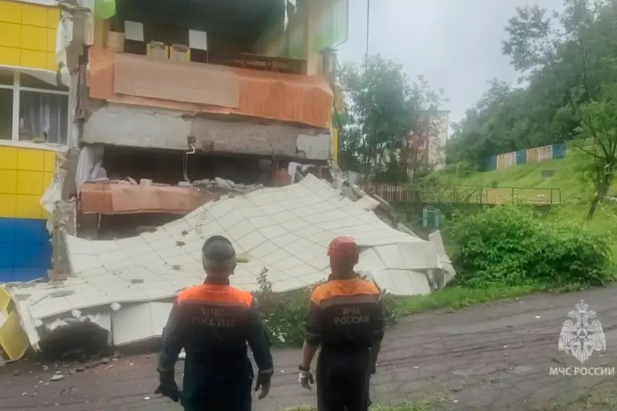
A massive 8.8 magnitude earthquake struck east of Petropavlovsk-Kamchatsky, Russia, on Wednesday. The event was caused by shallow reverse faulting, as the Pacific plate continues its west-northwest movement relative to the North America plate at an estimated rate of 77 mm per year, according to the United States Geological Survey (USGS). It is important to note that the North American plate extends westward beyond the limits of the North American continent itself.
The earthquake's characteristics—its location and direction of movement—align with the pattern of faulting seen along the subduction zone plate interface of the Kuril-Kamchatka Arc.
While earthquakes are often represented as a single point on a map, events of this scale involve substantial fault areas. In the case of the July 29 earthquake, the reverse faulting is estimated to have occurred over a fault zone roughly 390 km long and 140 km wide.
The Kuril-Kamchatka Arc is known for its regular seismic activity, with a long history of moderate to large-scale earthquakes. Within 250 km of Wednesday’s epicentre, 31 other earthquakes of magnitude 6.5 or above have occurred over the past century. Just nine days before this event, a 7.4 magnitude earthquake struck the same region on July 20, 2025. That event is now considered a foreshock to the larger magnitude 8.8 quake on July 29.
The latest earthquake's epicentre lies just 45 km southeast of the location of the 1952 9.0 magnitude Kamchatka earthquake. That historical event triggered a devastating tsunami across the Pacific Ocean, underlining the seismic risks associated with this active tectonic region.
Published: 30 Jul 2025, 08:12 am IST
Related Topics
Disclaimer: Kindly avoid objectionable, derogatory, unlawful and lewd comments, while responding to reports. Such comments are punishable under cyber laws. Please keep away from personal attacks. The opinions expressed here are the personal opinions of readers and not that of Mathrubhumi.
