Tamil Nadu is preparing for a major upgrade in land mapping, with high-resolution satellite imagery set to replace outdated 2D datasets and improve land administration.
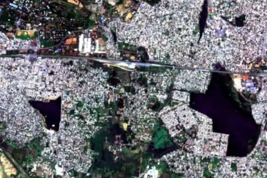
Chennai: Tamil Nadu is gearing up for a landmark transformation in its land survey, mapping and records management system, with the Directorate of Survey and Settlement initiating the procurement of high-resolution satellite imagery (HRSI) to cover the entire state.
The move is aimed at modernising land records, improving transparency in land administration, reducing property disputes, and enabling accurate geospatial mapping across Tamil Nadu.
According to officials, a request for proposal (RFP) has been issued to build a comprehensive HRSI database spanning nearly 1.3 lakh sq km. The imagery will serve as the backbone of a statewide digital land-mapping ecosystem to support governance, urban planning, infrastructure development and citizen services.
The upcoming satellite-powered land records system will allow precise latitude-longitude mapping, a significant upgrade from the existing 2D land datasets that often fail to reflect ground-level realities.
Once integrated with the Tamil Nadu Geographical Information System (TNGIS), the new imagery will enable authorities to identify and correct mismatches between legacy survey boundaries and actual property lines.
Officials say this will help fast-track patta transfer, subdivision approvals, reclassification of land parcels and dispute resolution.
The enhanced imagery will also play a crucial role in detecting land encroachments on water bodies, public land and government assets. With near-real-time visuals capable of highlighting even minor intrusions, enforcement agencies will be able to act faster and with stronger documentary evidence.
Multiple departments, including those overseeing infrastructure development, environmental monitoring, disaster management and welfare programme implementation, are expected to benefit from the high-accuracy database.
Tamil Nadu has steadily modernised its land administration systems in recent years, but the absence of updated high-precision satellite data has remained a major challenge.
The new platform will provide a unified, transparent and scientifically reliable foundation for decision-making in land management, reducing ambiguity in property boundaries and minimising delays in both private and public projects.
By adopting advanced satellite technology and geospatial intelligence, Tamil Nadu aims to deliver a citizen-friendly, dispute-free and future-ready land information system that benefits residents, planners, investors and administrators alike.
IANS
Published: 04 Dec 2025, 01:09 pm IST
Related Topics
Disclaimer: Kindly avoid objectionable, derogatory, unlawful and lewd comments, while responding to reports. Such comments are punishable under cyber laws. Please keep away from personal attacks. The opinions expressed here are the personal opinions of readers and not that of Mathrubhumi.
