
This follows heavy rainfall on Tuesday, which also affected several parts of Delhi, including Minto Bridge, Vijay Chowk, Moti Bagh flyover, Rafi Marg, and Nizamuddin flyover..
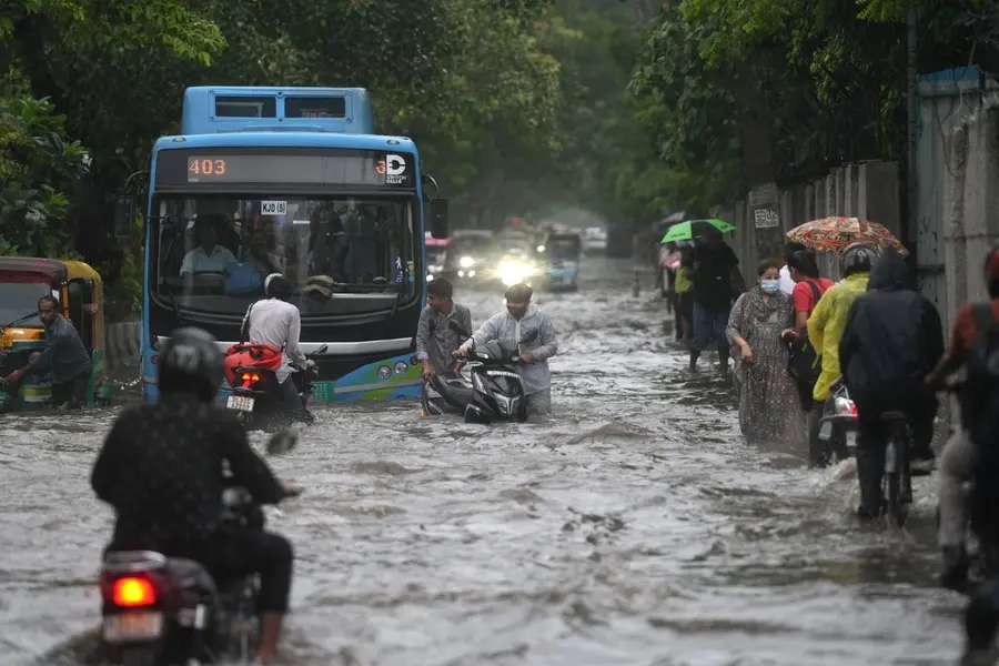
New Delhi: Heavy rain battered parts of Delhi and the National Capital Region (NCR) in the early hours of Thursday, bringing intense showers to areas such as Lajpat Nagar, RK Puram, Lodhi Road, and the Delhi-Haryana border.
The India Meteorological Department (IMD) has issued a red alert for Delhi, warning of continued heavy rainfall in the capital until 19 August. An orange alert has also been issued for several districts in Uttarakhand, where heavy rain is expected from 14 to 17 August. Meanwhile, parts of Telangana are also witnessing intense downpours, as monsoon activity remains widespread across several states.
Delhi’s downpour follows heavy rainfall on Tuesday, which also affected several parts of Delhi, including Minto Bridge, Vijay Chowk, Moti Bagh flyover, Rafi Marg, and Nizamuddin flyover.
The India Meteorological Department (IMD) had forecast thunderstorms with rain for Tuesday. Temperatures in Delhi are expected to range between a maximum of 34°C and a minimum of 25°C.
According to latest India Meteorological Department (IMD) reports, intense rain bands over Delhi-NCR, with light to moderate rainfall across most areas. Thunderstorms and heavy rain are expected in the next 2-3 hours.
Has Yamuna reached warning mark?
The water level of the Yamuna river in Delhi reached 204.43 metres at the Old Railway Bridge on Thursday morning, approaching the city's warning threshold of 204.50 metres, officials reported.
Authorities are closely monitoring the situation and have instructed all relevant agencies to implement precautionary measures in anticipation of a possible flood-like scenario.
At 9 am, the water level was recorded at 204.43 metres at the Old Railway Bridge, a crucial monitoring point for flood risk assessment in the city. The warning level for the river in Delhi is set at 204.5 metres, while the danger mark is 205.3 metres, and evacuation protocols begin once the level reaches 206 metres.
Officials attributed the rising water level to the large volumes of water being released hourly from the Wazirabad and Hathnikund Barrages. These releases follow heavy rainfall in the river’s upper catchment areas in Haryana and Uttarakhand, leading to increased inflow downstream.
Meanwhile, in Himachal Pradesh, public infrastructure continues to suffer severe damage due to persistent heavy rainfall and related incidents. According to the State Disaster Management Authority (SDMA), 323 roads, 70 electricity distribution transformers (DTRs), and 130 water supply schemes were disrupted in the past 24 hours.
Published: 14 Aug 2025, 10:24 am IST
Disclaimer: Kindly avoid objectionable, derogatory, unlawful and lewd comments, while responding to reports. Such comments are punishable under cyber laws. Please keep away from personal attacks. The opinions expressed here are the personal opinions of readers and not that of Mathrubhumi.
