
In an interview with Mathrubhumi, Dr Roxy Mathew Koll calls for localised flood management, protection of wetlands and stronger disaster preparedness to tackle future climate risks.
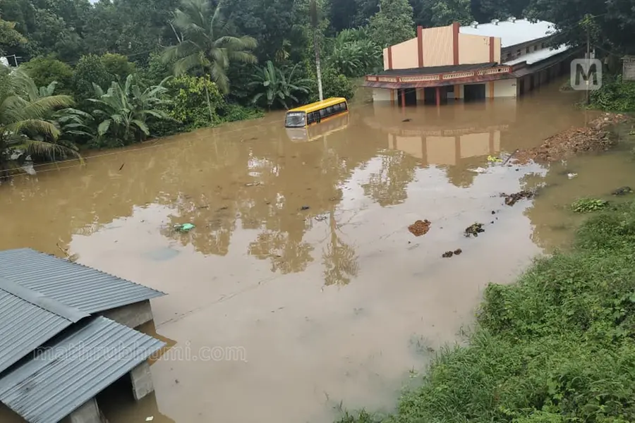
Thiruvananthapuram: Kerala must prepare for extreme rainfall events, far beyond what the state has experienced so far, as climate change continues to intensify weather extremes, climate scientist Dr Roxy Mathew Koll said.
How do you assess the flood-like situation in Kerala?
The recent rainfall ranged between 100 mm and 300 mm, and even that caused extensive damage. Maharashtra and Gujarat have already experienced rainfall of up to 1,000 mm. Climate change has become that severe. Kerala should prepare for rainfall exceeding 500 mm while planning infrastructure and disaster preparedness. Buildings and development projects should be designed keeping in mind climate conditions that could emerge over the next 100 years.
Kerala had explored models such as 'Room for the River'. What should be done now?
There is no single solution to deal with floods or drought. A Hindi proverb says we must learn both to hold back flowing water and to let it pass. That is the lesson for Kerala. There is no one path to achieve this, but if we implement multiple measures, we can significantly reduce the impact of floods and drought.
Models imported from elsewhere will not work entirely in Kerala. The state's geography, climate, river systems, local experiences, scientific knowledge and administrative leadership all have to come together to develop location-specific solutions.
Does that mean Kerala cannot have a single model for flood management?
Kerala should be viewed as three distinct regions: the highlands, the midlands and the coastal belt. These regions are interconnected. Any changes in the hills will affect the other two regions through rivers.
If excessive quarrying is carried out in the highlands, the terrain will not be able to withstand the intense rainfall caused by climate change, increasing the likelihood of landslides.
The rivers then carry mud and rocks downstream, increasing pressure on other regions. The traditional lifestyle of people living in the hills evolved over generations, and any changes should take their experience into account.
Similarly, placing rocks along the coast is not the only solution to prevent coastal erosion. In some places, biological barriers have proven effective. Rivers can also be protected using locally suitable methods. Localised models are the best approach.
Some say rivers should be deepened, while others disagree. Which view is correct?
Saying rivers should simply be dredged is the easy answer. Dredging often alters the natural character of rivers. Many other issues need to be addressed first.
Earlier, rivers were converted into canal-like channels by constructing embankments. It was a good decision to stop that practice.
A river is not just its channel. It includes its sandbanks, adjoining wetlands, streams that feed into it and nearby paddy fields. We cannot expect to restore rivers while destroying wetlands, streams and paddy fields.
The remaining wetlands, streams and paddy fields must be protected. Every land reclamation and construction activity that destroys them increases flood risk.
Can you suggest a comprehensive programme for Kerala?
Every district should map its drainage channels. Panchayat-level monitoring committees should be formed with local residents, elected representatives and officials from various departments.
Similar committees should function at the district level, with coordination at the state level.
These local committees should monitor rainfall and river conditions, collect data and share it with the state. In return, weather department data should also be communicated back to them.
The Meenachil River Committee, which monitors the river from Vagamon to Kumarakom, is a good example. Changes in Vagamon are immediately communicated to Kumarakom. During the 2018 floods, timely warnings that floodwaters were approaching helped save many lives.
Does the India Meteorological Department still face limitations?
Yes. There are still too few weather stations collecting rainfall and temperature data. More data will improve disaster preparedness.
The weather department should also make use of quality observations collected by local monitoring groups.
Many times, rainfall measurements from areas that receive extremely heavy rain are not available to the weather department. Better coordination among the India Meteorological Department, the Geology Department, local governments and community monitoring groups is essential for effective disaster management.
Published: 05 Aug 2026, 09:39 am IST
Related Topics
Disclaimer: Kindly avoid objectionable, derogatory, unlawful and lewd comments, while responding to reports. Such comments are punishable under cyber laws. Please keep away from personal attacks. The opinions expressed here are the personal opinions of readers and not that of Mathrubhumi.
