
More than 500 people hold land titles in these two areas, and the survey can only be completed if they present the required documents.
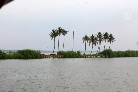
Alappuzha, Kerala: The digital survey in Kainakary village of Kuttanad has hit a roadblock, with the Survey Department facing difficulty in tracing the owners of Rani and Chithira kayal lands.
More than 500 people hold land titles in these two areas, and the survey can only be completed if they present the required documents.
So far, around 50% of the digital survey in Kainakary village has been completed. The remaining portion involves surveying the Rani and Chithira kayal lands. Many of the land title holders live outside the district, some outside the state, and a few even abroad. The survey can be completed only if all of them appear with proper documentation.
The Survey Department has contacted paddy field committees to trace the owners, but without success. Many of the landowners visit only once a year to lease out their land, making it difficult to establish contact, especially with those living abroad. The matter is set to be brought to the attention of the District Collector on Monday.
After the survey, the final procedures will be carried out only after verifying the documents held by landowners. The process requires owners to present documents such as title deeds and land tax receipts.
So far, surveys have been completed in 12 villages in the district, while work is ongoing in 19 villages.
Chithira Kayal spans 716 acres, and Rani Kayal covers 568 acres. These lands were reclaimed by constructing bunds around the water bodies and draining water for paddy cultivation. The reclamation was carried out under the directive of Sree Chithira Thirunal Maharaja by Joseph Murickan, commonly known as Murickan Outhachan, a prominent farmer and landowner. The area includes both patta (titled) land and government (puramboke) land.
Published: 19 Apr 2026, 02:37 pm IST
Related Topics
Disclaimer: Kindly avoid objectionable, derogatory, unlawful and lewd comments, while responding to reports. Such comments are punishable under cyber laws. Please keep away from personal attacks. The opinions expressed here are the personal opinions of readers and not that of Mathrubhumi.
