Monsoon sweeps into Delhi; Mumbai faces flooding, traffic chaos and red alert | VIDEO
New Delhi/Mumbai: The southwest monsoon intensified across northern and western India on Thursday, bringing showers to Delhi-NCR while torrential rain battered Mumbai, causing widespread waterlogging, traffic disruption and prompting weather alerts across several districts.
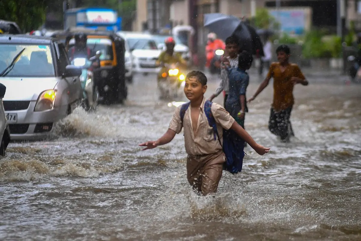
In Mumbai, heavy rainfall since the early hours of Thursday inundated several parts of the city, with roads in areas such as Andheri, Kings Circle and Gandhi Market submerged, disrupting vehicular movement. Waterlogging was also reported on railway tracks at Dadar station, affecting normal commuting.
The India Meteorological Department (IMD) issued a nowcast red alert for Mumbai, Thane, Palghar and Raigad, forecasting moderate to intense spells of rain at isolated places over the next few hours. Residents were advised to avoid low-lying and waterlogging-prone areas, stay away from weak structures, trees and electric poles, and keep track of weather updates.
According to IMD data, Mumbai's eastern suburbs recorded some of the highest rainfall between 8 am on July 1 and 7 am on July 2. Mithagar Municipal School in Mulund received 230.8 mm of rain, followed by Mankhurd Fire Station with 228.6 mm and the S Ward Office with 227 mm. Several locations across the city and western suburbs also recorded more than 200 mm of rainfall during the period.
Meanwhile, the national capital received moderate rainfall on Thursday, bringing relief from the prevailing heat and humid conditions. The IMD issued a yellow alert for Delhi-NCR, forecasting cloudy skies, light to moderate rain and gusty surface winds.
Delhi recorded a maximum temperature between 33°C and 34.8°C on Wednesday, significantly lower than the temperatures seen during the recent heatwave. The weather department has forecast similar conditions over the next 24 hours, with continued chances of rain.
Senior IMD scientist Naresh Yadav said the southwest monsoon is expected to advance further into Punjab, Haryana, Delhi-NCR, Uttar Pradesh and parts of Gujarat's west coast over the coming days.
He also warned of extremely heavy rainfall over the Konkan region, Goa and south Gujarat during the next four to five days, with a red alert issued for these areas. Very heavy rainfall is also expected across parts of Odisha and central India.
In Chandigarh, IMD Director Surinder Paul said the monsoon has already entered parts of Punjab and Haryana and is likely to cover the remaining regions within the next two to three days, bringing widespread rainfall and further relief from heat and humidity.
With the monsoon strengthening across large parts of the country, authorities have urged residents in vulnerable areas to remain cautious and follow official weather advisories.
(With inputs from PTI)