Tropical storm Bertha nears Florida coast; heavy rain, flash floods and strong winds forecast
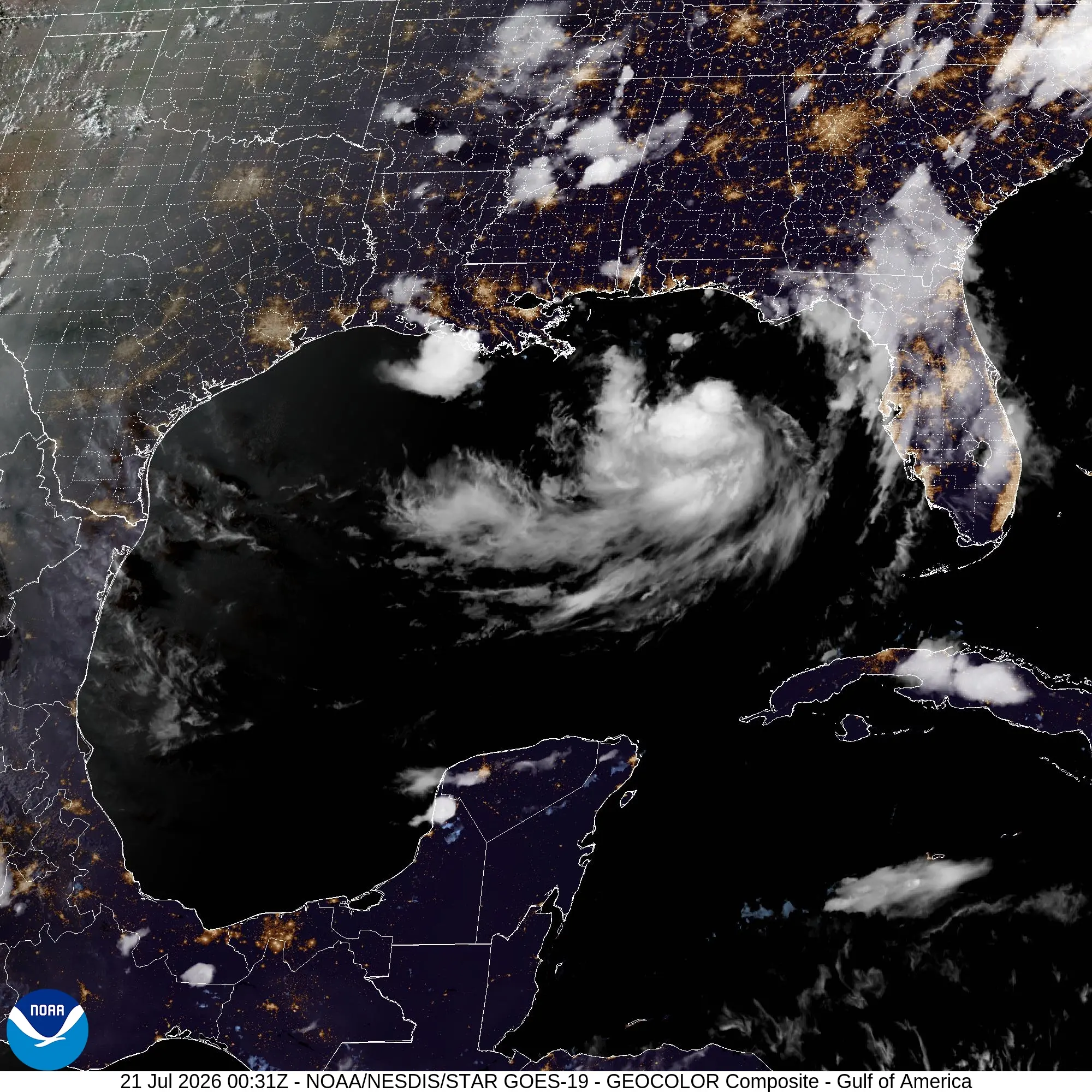
New Orleans: Tropical Storm Bertha formed over the Gulf of Mexico on Monday evening, prompting warnings of heavy rainfall, damaging winds, storm surge and possible flash flooding along the northern US Gulf Coast as the system slowly tracks toward land, according to the US National Hurricane Center (NHC).
The storm was located about 110 miles (180 km) south of Panama City, Florida, at 8 pm local time, with maximum sustained winds of 40 mph (65 kmph). Forecasters said Bertha is expected to strengthen further before approaching the coast.
The Miami-based National Hurricane Center said the storm has been moving west-northwest at around 3 mph (6 kmph) but is forecast to make a gradual turn toward the northwest, remaining near or along the northern Gulf Coast through early this week.
Heavy rain is expected to impact northern Florida, Alabama, Mississippi and Louisiana, before the system gradually pushes westward toward Texas. Forecasters warned that the slow-moving nature of the storm could significantly increase the risk of flooding.
A Tropical Storm Watch has been issued from the Ochlockonee River in Florida westward to southeastern Louisiana, while a Storm Surge Watch is in effect from the mouth of the Mississippi River to the Alabama-Florida border.
The hurricane centre warned that life-threatening storm surges of up to four feet (1.2 metres) are possible along parts of the Louisiana and Mississippi coastlines. It also cautioned that Bertha could produce an isolated tornado or two across Florida's Big Bend region later this week.
Flash flooding remains a major concern from western Florida to central Texas through Friday. Rainfall totals of 3 to 5 inches (7–12 cm) are forecast along the Louisiana coast, with isolated locations expected to receive even higher amounts.
The US authorities have already begun precautionary measures. Red flags were raised at beaches in Orange Beach, Alabama, warning of dangerous surf and rip currents, while emergency officials in Escambia County, Florida, distributed sand for residents in flood-prone communities to prepare sandbags.
Bertha is the second named tropical storm of the 2026 Atlantic hurricane season, following Tropical Storm Arthur, which brought widespread rainfall to the southeastern United States last month.
Meanwhile, in the eastern Pacific, Tropical Storm Fausto continued to strengthen and was nearing hurricane intensity. The system, packing sustained winds of 70 mph (110 kmph), was located about 745 miles (1,205 km) south-west of the southern tip of Mexico's Baja California Peninsula on Monday. The NHC said Fausto was moving north-west at 10 mph (17 kmph) and currently poses no threat to land.