India’s NavIC: Securing home before reaching the world
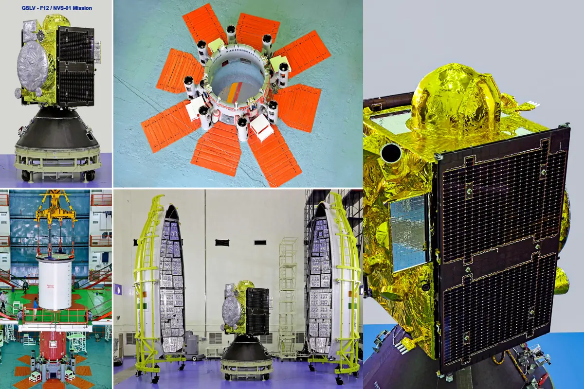
On the morning of October 31, 2026, engineers at the Indian Space Research Organisation confirmed that NVS-03, launched a day earlier aboard the GSLV-F18 from Sriharikota, had completed its first orbit-raising manoeuvre, a gentle engine push that lifts the satellite towards its correct height. Several more such pushes and weeks of testing remain before it begins serving the country. Yet even at this early stage, the mission has revived a question that stirs national pride and demands honest arithmetic in equal measure: can NavIC, India's own navigation system, ever stand beside America's GPS, China's BeiDou and Russia's GLONASS?
Honesty requires beginning with what others have built. The American GPS runs on a minimum of 24 satellites, and in practice usually keeps 30 or more aloft. Russia's GLONASS relies on 24. Europe's Galileo fields 24 or more. China's BeiDou, in its established worldwide form, uses 35, mixing satellites across several kinds of orbit. India's NavIC was designed for just seven, and until NVS-03 arrived, only three were actually working. These numbers describe how each system was planned rather than the exact count operating on any given day, but the gap is plain enough.
Why does GPS need so many when one person's location can be fixed by four? Because the Earth is a sphere and satellites never stand still. A satellite overhead in Chennai is invisible from Chicago. To guarantee that anyone, anywhere, can see at least four at once, GPS scatters its satellites across six orbital pathways roughly 20,200 kilometres up. Think of it as positioning lamps around a globe so that no corner is ever left in shadow. The lesson is vital: worldwide coverage comes from where satellites sit, not merely how many there are. Multiplying NavIC's present orbits from seven to 24 would not, by itself, light up the whole planet.
ALSO READ: ISRO's NVS-03 launch successful; boost for India's positioning and timing services
The four-satellite rule deserves a moment. When your phone shows that small blue dot on a map, it is listening to satellites broadcasting two things: where they are and the exact time. By measuring how long each signal takes to arrive, the phone works out its own position. Three satellites fix your spot on the ground; a fourth corrects the humble clock inside your handset, which is nowhere near precise enough on its own. Height and time come along as part of the calculation.
NavIC, short for Navigation with Indian Constellation, was never meant to cover the globe. Its purpose was to free India from foreign dependence within its own neighbourhood, serving the mainland and a belt stretching about 1,500 kilometres beyond it. The original design parked three satellites above fixed points on the equator, with four more circling in orbits tilted slightly away from it. Those four, if you stood in the same spot and looked up at the same hour each day, would seem to wander slowly across the sky in the shape of the number 8, like a pendulum swinging north and then south. That looping path lets them cast signals over India's far north and deep south alike.
Then age caught up. Satellites wore out and several atomic clocks, the heartbeat of any navigation spacecraft, failed. By July 2026, the government acknowledged that just three satellites were still delivering positioning, navigation and timing. NVS-03 should lift that to four once it settles into its working orbit and clears its checks. It is a genuine recovery, but a fragile one: with four, a single further failure would push the system back to the edge.
Atomic clocks deserve respect here. They measure time so finely that a slip of a billionth of a second matters, because signals travel at the speed of light and a tiny timing error becomes a large error on the ground. NVS-03 carries an atomic clock built in India, a quiet triumph of self-reliance, and supports the L1 frequency, the same radio band ordinary phones already use for GPS, which makes NavIC far easier for everyday receivers to pick up.
So what should India chase? Two destinations lie ahead. The nearer one is to restore all seven planned positions and keep spares ready; NVS-04 and NVS-05 are already being built for that purpose. The farther one is worldwide reach, which would demand a wholly new orbital design of at least 24 well-placed satellites, realistically 24 to 30 or more with backups. That figure is an engineering estimate, not an approved national plan.
Beyond hardware, ISRO must sharpen its ground monitoring, launch replacements before old satellites falter, and persuade manufacturers to put NavIC into more phones and vehicles. For the armed forces, a trustworthy Indian signal guiding aircraft, ships and missiles without leaning on foreign goodwill is a matter of sovereignty.
India has proved it can build a navigation system of its own. The harder, prouder task is making it work every single day, close to home, before it reaches for the whole sky.
(Girish Linganna is an award-winning science communicator and a Defence, Aerospace & Geopolitical Analyst. He is the Managing Director of ADD Engineering Components India Pvt. Ltd., a subsidiary of ADD Engineering GmbH, Germany.)