Explainer: How ISRO's 100th mission, launch of NVS-02 satellite, powers India’s GPS alternative
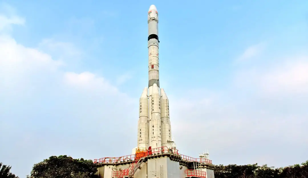
The Indian Space Research Organisation (ISRO) is getting ready to launch the NVS-02 satellite (2nd generation of NavIC) at 6:23 am on January 29, 2025. The satellite will be sent to space using the Geosynchronous Satellite Launch Vehicle (GSLV) Mk-II rocket. This launch will be a special occasion at SHAR, as it marks ISRO’s 100th mission, including some sub-orbital flights and a few other unique launches.
This mission aims to strengthen India’s satellite navigation system, which ISRO has been building, and improving, over time. The mission is called the GSLV-F15/NVS-02 Mission and will carry the IRNSS-1K satellite. This satellite is part of India’s navigation satellite network. The Navigation Satellite (NVS), is a part of Navigation with Indian Constellation (NavIC)—India’s own version of a global navigation satellite system (GNSS), similar to the GPS commonly used around the world.
The GSLV-F15 mission will be the 17th flight of India’s GSLV. It will also be the eighth operational flight (and 11th overall) using India’s homegrown cryogenic engine.
According to media reports, the main goals of the mission under the NavIC system are to provide support for:
* Accurate military operations and strategic purposes
* Navigation across land, air and sea
* Precision farming and agricultural activities
* Land-mapping and geodetic surveys
* Quick response during emergencies and disasters
* Efficient fleet management and mobile location-based services
* Accurate satellite orbit tracking
* Guidance for marine fisheries
* Reliable timing services for financial systems, power grids and government organizations
* Applications using Internet-of-Things (IoT) technology
The NVS-02 is the second satellite in the new generation of navigation satellites and the ninth one in the NavIC system. Similar to the earlier NVS-01, it is expected to carry two types of payloads:
* A navigation payload for location services, and
* A ranging payload for accurate measurements
The navigation payload transmits signals to users on Earth using three frequency bands: L1, L5 and S band.
* L1 Band (1575.42 MHz): A frequency used for civilian navigation, providing reliable location data for general users
* L5 Band (1176.45 MHz): A higher-frequency band offering more accurate and secure navigation, often used for military and aviation purposes
* S Band (2492.028 MHz): A frequency used for communication and tracking, ideal for short-range and high-speed signal transmission
Time is not a constant and can be influenced by various factors, so an atomic clock is included in this payload to ensure accurate time-keeping. Typically, it uses a Rubidium atomic clock.
What is a Rubidium Atomic Clock?
A Rubidium atomic clock is a highly accurate device that keeps time by measuring the vibrations of Rubidium-87 atoms. It is often used in satellites and navigation systems to provide precise timing. These clocks are incredibly accurate, with an error margin of just three parts in 10 quadrillion. In simple terms, they can stay accurate to within one second over 100 million years!
Transponder for Accurate Timing
The ranging payload includes a transponder, which allows the navigation satellite to send time-stamped signals to receivers on the ground, helping them determine accurate positions and timings. The data from the satellite is processed by users to determine their exact location, speed and time. This ensures continuous and reliable service, no matter the weather conditions on Earth.
Regional Systems May Go Global
The second-generation NavIC satellites come with a stronger encryption system, ensuring that all communications are fully secure and protected from unauthorized access. Like the US GPS, India’s NavIC is designed for both civilian and military use. It was previously called the Indian Regional Navigation Satellite System (IRNSS) and had a smaller coverage area.
There are currently four global navigation systems: GPS from the USA; GLONASS from Russia; Galileo from the European Union; and BeiDou from China. India’s NavIC and Japan’s QZSS are regional systems for now, but could become global in future.
About the NVS-01 Satellite
On May 29, 2023, the GSLV-F12 rocket successfully placed the 2,232 kg NVS-01 satellite into a Geosynchronous Transfer Orbit (GTO). ISRO explained that the NVS-01 satellite had a special Rubidium atomic clock made in India which helped the satellite keep perfect time, which was important for navigation systems. The satellite also included L1 band signals, which allow it to send data over a wider range, improving the performance of NavIC, India’s navigation system.
NavIC 01 vs 02: Differences
While both the NavIC 01 (NVS-01) and NavIC 02 (NVS-02) are part of India’s regional navigation satellite system (NavIC), there are some key differences between them. Here’s a breakdown:
NavIC 01 (NVS-01)
* Launch Date: May 29, 20231
* Launch Vehicle: GSLV-F122
* Weight: 2,232 kg3
* Orbit: Geosynchronous Transfer Orbit (GTO)4
* Mission Life: 12 years
Key Features
* Indigenous atomic clock: Carries a Rubidium atomic clock developed in India.5
* L1 band signal: Transmits signals in the L1 band, increasing compatibility with other navigation systems.6
* High-speed data link: Enables faster data transmission.
NavIC 02 (NVS-02)
* Launch Date: Expected 29th January 2025
* Launch Vehicle: GSLV2
* Weight: Likely similar to NVS-01 or slightly heavier.
* Orbit: Expected to be placed in Geosynchronous Transfer Orbit (GTO)
* Mission Life: Expected to be greater than 12 years.
Key Features
* Enhanced features: Likely to build upon the advancements of NVS-01 with further improvements in accuracy, signal processing and security
* Improved atomic clock: May carry a more advanced version of the indigenous atomic clock
* L1, L5 and S band signals: Will transmit signals in L1, L5 and S bands for wider compatibility and improved accuracy
This multi-band capability is a significant advancement for NavIC. It not only enhances compatibility with other global navigation systems, but also improves the accuracy and reliability of positioning information. Overall, the NVS-02 represents the next step in the evolution of India’s NavIC system. It builds upon the successes of the NVS-01 and incorporates further technological advancements to enhance the system’s capabilities and performance.
The author of this article is an award-winning Science Writer and a Defence, Aerospace & Political Analyst based in Bengaluru.