Glacier collapse or lake burst likely behind Dharali flash flood, not cloudburst – Experts
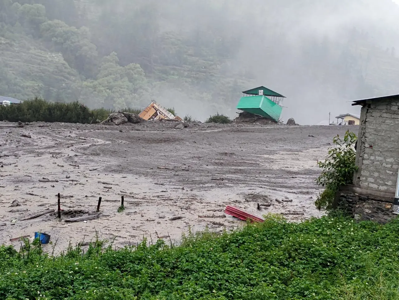
Dehradun: destructive flash flood struck Dharali village in Uttarkashi district on Tuesday, causing significant damage to infrastructure and raising alarm in the Himalayan region.
While initial reports suggested a cloudburst was to blame, emerging expert opinions and data now point towards a glacier-related event as the real cause.
What is a glacier and a glacial lake?
A glacier is a large, slow-moving mass of ice formed from compacted layers of snow. These are typically found in high-altitude regions such as the Himalayas. Over time, glaciers can melt and release water.
A glacial lake forms when meltwater from a glacier accumulates, often dammed by ice or moraines (natural debris). If the dam weakens or collapses, the stored water can be suddenly released, causing a Glacial Lake Outburst Flood (GLOF) — a high-energy flash flood that can travel quickly downstream and destroy everything in its path.
Rainfall data doesn’t support cloudburst theory
According to the India Meteorological Department (IMD), rainfall in the region at the time was too minimal to cause such flooding. Harsil recorded only 6.5mm of rain on Tuesday, with a cumulative 24-hour total of 9mm. Bhatwari logged 11mm, and the highest recorded rainfall across Uttarkashi district was just 27mm—well below the threshold for a typical cloudburst.
Rohit Thapliyal, senior scientist at IMD’s regional meteorological centre, confirmed, “Only very light to light rain was observed in the affected area.”
Experts point to glacier collapse or GLOF
Given the absence of substantial rain, scientists have turned their attention to other high-altitude causes. A glacial lake outburst flood (GLOF) or a glacier collapse is now considered the most likely explanation. A senior scientist involved in the investigation noted, “This volume of rainfall is insufficient to trigger such floods. We are looking at a powerful event such as a glacier burst or GLOF.”
Satellite images reveal glacial lakes above Dharali
Satellite imagery reviewed by The Times of India shows the presence of large glaciers and at least two glacial lakes directly upstream from Dharali. One of the glaciers lies above the Kheer Gad stream—a location that experts say could have been the origin point for a sudden water release.
“This could be similar to the Raini disaster in Chamoli in 2021,” the scientist added. That incident involved a rock-ice avalanche and led to catastrophic flooding, killing over 200 people and destroying hydropower infrastructure.
Rainfall far below cloudburst levels
According to Time of INdia reports the India Meteorological Department (IMD) has ruled out a cloudburst as the likely cause of the Dharali flood, citing insufficient rainfall. Harsil, near the affected area, recorded just 6.5mm of rain on Tuesday, with a 24-hour total of 9mm. Bhatwari received 11mm, and the highest in the district was 27mm—far below the threshold typically associated with cloudburst-induced flooding.
Rohit Thapliyal, senior scientist at IMD’s regional meteorological centre, confirmed: “Only very light to light rain was observed in the area. These levels are not capable of generating such a severe flood.”
Experts suspect glacier collapse or lake breach
Given the limited rainfall, experts believe a more powerful event such as a glacier collapse or glacial lake breach triggered the flood. These natural disasters are becoming more frequent due to rising global temperatures, which increase glacier melt and glacial lake volume.
A senior scientist told The Times of India: “The rainfall alone is not enough to account for the intensity of the flood. Satellite images show glaciers and glacial lakes directly upstream of Dharali, which strongly suggests a glacial lake outburst or glacier collapse is responsible.”
Satellite images confirm glacial activity near flood site
Satellite imagery accessed by TOI reveals at least two significant glacial lakes and multiple glaciers situated directly above the Kheer Gad stream—believed to be the route through which the floodwater surged into Dharali.
This has prompted comparisons with the Raini disaster in Chamoli (February 2021), where a rock-ice avalanche led to a sudden flood, killing over 200 people and severely damaging two hydropower projects.
Uttarakhand’s rising glacial lake risk
The Wadia Institute of Himalayan Geology has identified 1,266 glacial lakes across Uttarakhand, ranging from small ponds to large reservoirs. Many of these lakes are unstable, posing a constant threat to communities downstream.
The National Disaster Management Authority (NDMA) has classified 13 of these glacial lakes as high-risk, with five labelled as extremely dangerous due to their potential to trigger catastrophic floods if breached.
Experts urge increased monitoring of Himalayan glaciers
Piyoosh Rautela, senior geologist and former executive director of the Uttarakhand Disaster Management Authority, explained:
“Such disasters typically occur when water collects at higher altitudes and is suddenly released due to dam failure or ice collapse. Heavy rainfall alone cannot produce the kind of destruction witnessed in Dharali.”
With global warming accelerating glacial melt, experts are calling for real-time monitoring, early warning systems, and detailed hazard mapping of glacial lakes to prevent future disasters in the Himalayan region.