Cyclone Senyar strikes Indonesia; Tamil Nadu, Kerala, Andhra to face severe downpours
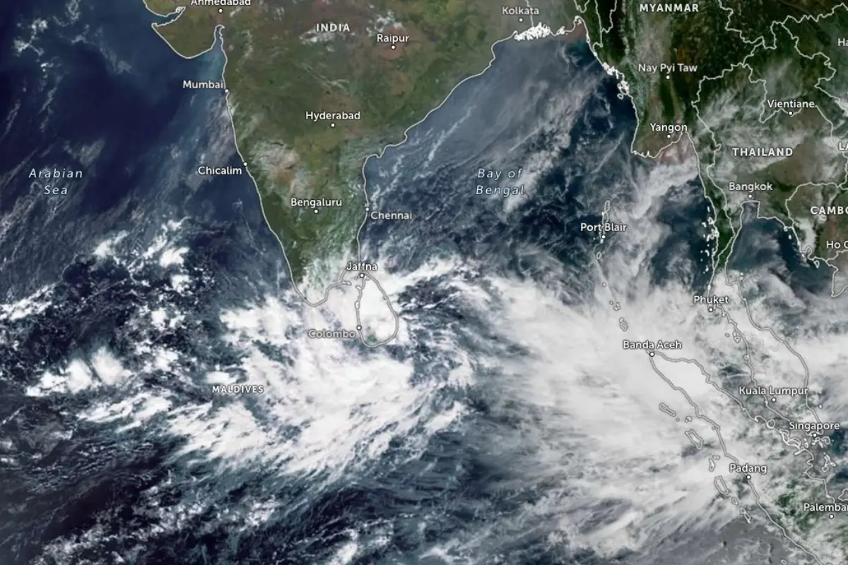
Mumbai: Cyclone Senyar, which formed over the Strait of Malacca and adjoining northeast Indonesia, crossed the Indonesian coast on Wednesday morning, bringing strong winds and heavy rainfall. According to the India Meteorological Department (IMD), the cyclone’s wind speeds ranged from 70-80 kmph, gusting up to 90 kmph.
Affecting areas of northeast Indonesia, the storm was centred approximately 80 km east of Kuta Makmur, 280 km west of George Town in Malaysia, and 580 km southeast of Nancowry in the Nicobar Islands. Senyar is forecast to continue moving west-southwestwards, maintaining cyclonic intensity until Thursday morning, before gradually weakening.
The IMD has issued warnings for heavy to very heavy rainfall over Nicobar and Andaman Islands, Puducherry, Tamil Nadu, Kerala, and Andhra Pradesh. Residents and authorities in these regions have been advised to remain alert and take precautionary measures.
Strong gale-force winds are expected over the Strait of Malacca, Malaysia, South Andaman Sea, Nicobar Islands, Indonesia, and Thailand. Wind speeds are forecast to decrease gradually: 50-60 kmph gusting up to 70 kmph by Thursday morning, and 40-50 kmph gusting up to 60 kmph from Friday morning.
In addition, a well-marked low-pressure area over the southwest Bay of Bengal, southeast Sri Lanka, and the Equatorial Indian Ocean is likely to intensify into a depression within 24 hours. It is expected to move north-northwestwards towards North Tamil Nadu and Puducherry over the next 48 hours, potentially bringing further heavy rainfall and strong winds.
IMD has urged residents to monitor updates closely, avoid venturing outdoors during strong winds, and follow local disaster management instructions. Fishermen have been advised not to venture into the sea until conditions stabilise.